Sunday, August 31, 2008

port essington

We all went out on the boat looking for marine creatures. Apart from the abundant crocodiles we also spotted a snub-nosed dolphin, sea turtles and manta rays.


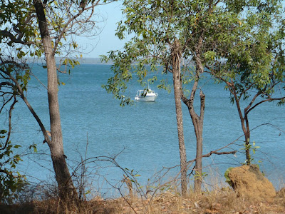
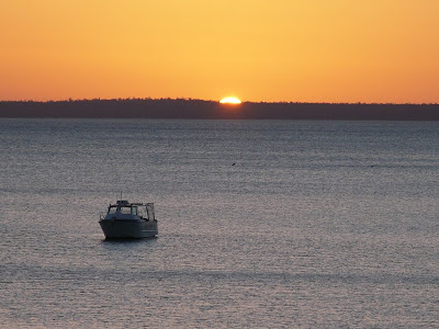
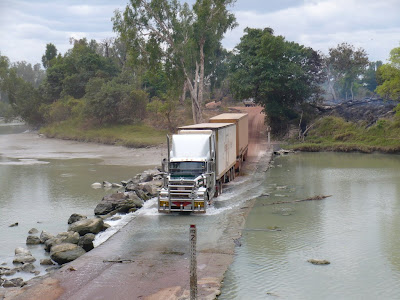
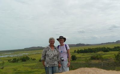
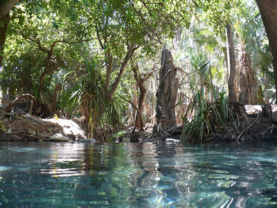
Our destination was the abandoned ruins at Port Essington, also known as Port Victoria. The story of this port is a classic tale of the Brits and their bungled attempts to settle on the northern coastline of Australia.

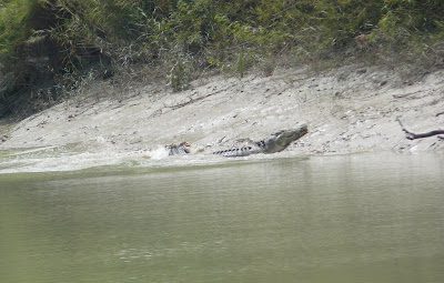
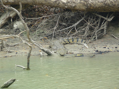
The peninsula was named by the explorer Phillip Parker King ( the chap who mistook crocodiles for alligators ) after Queen Victoria's uncle, Prince Leopold of Saxe-Cobourg. King also named the bay Port Essington after his friend Vice Admiral Sir William Essington, so he was a bit of a sycophant as well as misguided.

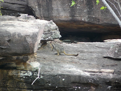
The impulse to settle the northern extremity of Australia was largely driven by the prospect of a rival French settlement. There were three unsuccessful British settlements in the area. Problems were caused by monsoonal weather, voracious wildlife, very unfriendly local Aborigines, and the lethargy which inevitably affects Europeans who try to work in the tropics.

Port Essington was actually chosen as the site of the first settlement but when the organising party, led by Captain J. J. Gordon Bremer, arrived in 1824 they found that there was no fresh water and so, after three days, they moved to Melville Island where the settlement at Fort Dundas was established. This lasted a mere four years before scurvy, tropical diseases, lack of fresh supplies, and antagonistic Aborigines forced it to be abandoned.

In 1827 a second attempt at a settlement was made by Captain James Stirling at Raffles Bay. The history of the settlement was a carbon copy of the problems at Fort Dundas and closed down after two years

You would assume that they would be getting the message by now, but far from it- off they went again......

In 1837 the British government decided to try again and a settlement was established at Port Essington . In 1838 Captain J. J. Gordon Bremer (who, by this time, must have been convinced that he was really out of luck when it came to leading expeditions) arrived at Port Essington.

In the first 12 months the settlement, which had comprised of a hospital, officers quarters and 24 cottages had been a mixture of prefabricated buildings brought from Sydney and cottages built from local materials but lacking any real skill as the builders were amateurs. It would have been too much to bring some qualified construction workers obviously.

The settlement was virtually wiped out by a cyclone in November, 1839 which meant that they had to start all over again.


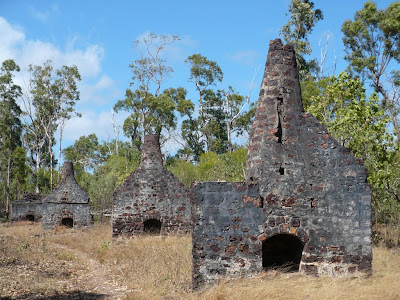
The second phase involved the rebuilding of the settlement but this time the builders were assisted by a brick maker who had been shipwrecked during the cyclone ( unlucky sod!). The result was a mixture of local materials with stone chimneys and some brick buildings including fortifications and a baker's oven.


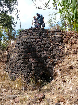
The final phase of building occurred in 1844 when a group of convicts including trained masons and quarry men were stationed briefly at Port Essington. The skills of these tradesmen resulted in a beacon and a sophisticated hospital but it was all too late. The settlement was abandoned in 1849 and today it is nothing more than a collection of ruins.

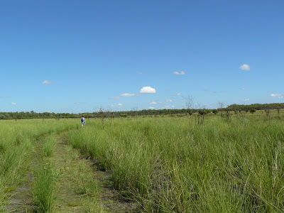
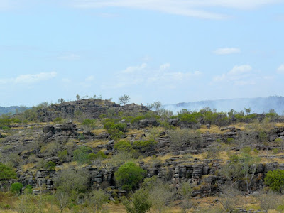
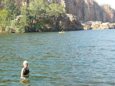
The 2 hour walk around the settlement in light cotton clothing was sweltering, so it is easy to see how the residents in their heavy woollen uniforms and clothing failed to thrive. We had a welcome break in the partial shade sitting on all their tombstones.

Thomas Huxley passed through the settlement just before it closed down in 1849 and left a graphic description of the sheer awfulness of Port Essington describing it as 'the most wretched, the climate the most unhealthy, the human beings the most uncomfortable and houses in a condition most decayed and rotten.'

gunbalanya; injalak hill art

Before reaching the national park we stopped at Gunbalanya to climb a few more rocks and see some more Aboriginal art. We needed a guide for this one as we climbed deeper and deeper through chasms and over ravines.With our sense of direction I suspect we would still be there without Simon's assistance.


There is so much fine rock art in Arnhem land, seen by very few people.


cobourg peninsula-garig gunak barlu national park

We have returned from the Cobourg peninsula after an amazing few days about as far from the madding crowd as possible.

The Coburg Peninsula is home to some of the best reef and tropical sports fishing in the world. The spectacular wilderness of Garig Gunak Barlu National Park encompasses almost all of Cobourg Peninsula. The park preserves the peninsula’s sandy beaches, dunes and associated coastal grasslands, mangroves, rainforest patches, swamps, lagoons, coral reefs, sea grass meadows and rich marine life.

The peninsula is two sailing days from Darwin ( 150 nautical miles ) and 1-2 days in a 4WD ( road access is only possible from May to October). Visitors to the area are restricted to a maximum of 20 vehicles at any one time (we saw 1 other while we were there).


It is always a good idea to broaden one's horizons by doing these groups tours and meet fellow travellers from all over the world, so we hooked up with Jo from Melbourne and Phillip from Mudgee!

The view from our tent was not too bad:


The other residents of this tropical paradise did prevent us from enjoying any ocean swimming:


Much more to write about the trip, but as we are off again this morning to see more of Kakadu I will post later on this week.

Meanwhile, I fear that Ness has gone completely feral and that we may never see another town or city again.

Wednesday, August 27, 2008

off to Arnhem Land

Tomorrow we are off on a 3 day tour to Arnhem Land which is the north-eastern corner of the Northern Territory. Now an area controlled by the Northern Land Council and inhabited by local Aborigines.

Arnhem Land is an area of 97 000 sq. km. It extends from Port Roper on the Gulf of Carpentaria around the coast to the East Alligator River where it adjoins Kakadu National Park. The region was named by Matthew Flinders after the Dutch ship Arnhem which explored the coast in 1623.

The coast has one of the longest histories of exploration of any area in Australia. It is likely that the first Aborigines, making their way across the Indonesian archipelago some 40-50 000 years ago, arrived on the Arnhem Land coast. Certainly by the fifteenth century the coast was being regularly visited by Indonesian and Malaccan sailors and traders.

In 1644 Abel Tasman sailed along the coast and in 1803 Matthew Flinders, as part of his circumnavigation of Australia, charted the complex coastline. The inland areas were explored by Ludwig Leichhardt, who travelled through the area on his 1844-45 journey from Moreton Bay to Port Essington, and David Lindsay, the South Australian surveyor, who, in 1883, was commissioned to explore the central and eastern sections of Arnhem Land. He met with strong resistance from the local Aborigines. At one point his party was attacked by over 300 men

The area is now inhabited by around 20,000 Aboriginal people, and access is strictly limited with permits required so the easiest way to explore is with an organised tour. We should see plenty of gingas, rock art, and hopefully sea turtles on the Cobourg peninsula.

Yesterday we found our first rock wallaby, tricky creatures to spot.


We also witnessed our first controlled bush fire, and they are pretty violent even when you know that they are being monitored. Non-Aboriginal people are now realising the value of this age old practice- now that traditional burning is back, the landscape is once again abundant with native flora and fauna. Patch burning in the cooler weather prevents wildfires, repairs country and encourages biodiversity.


Sulphur-crested cockatoos are quick to rummage through the ash looking for cracked seeds.


Large numbers of black kites surround the periphery of the burn to pick off fleeing lizards and small mammals.


So tomorrow we cross the East Alligator river ford, and will return on Sunday.

beware the ginga!

A sneaky blighter is Crocodylus porosus (the saltwater or estuarine crocodile). He trades on his misnomer by happily living in billabongs ( freshwater) as well as salt water, where he willingly eats hapless tourists should they fancy a swim. Last known tourist death here was in 2002.

By 1971, due to hunting for skins, the species was near extinction and became fully protected. Now there are an estimated 70,000 in the NT and they are moving further and further inland into freshwater rivers and billabongs. The Aboriginals call them 'gingas' and have an instinctive respect that European tourists appear to lack.

In Kakadu the gingas wait for the rainy season and then it is 'access all areas' and they spread over the whole region without challenge. At the start of the dry season the 'crocodile management' team have to find, trap and relocate all itinerants to reduce the risk to visitors. Traps baited with pig legs remain to entice the stragglers, although no guarantees are given that anywhere is ginga free.

Vanessa took us for 2 walks around the banks of the East Alligator river yesterday.We counted 8 large gingas on the opposite bank, and a Ranger informed us cheerily that they estimate that for every visible ginga there are 12 more hidden but in close proximity. So theoretically 96 hidden gingas were lurking.


I am not sure why I am so nervous about them here.We have encountered crocs in east and west Africa, and on the Amazon and I was not overly worried, but walking around here I just feel like adrenaline charged dinner. It may be the vast numbers here, the large amount of cover that the habitat provides, or just the fact that I am more aware of my own mortality as I get older, but whatever the reason these creatures terrify me.

I am not an advocate of hunting creatures to near extinction and never will be, but I do agree that the crocodile looks at its absolute best when polished to a mirror finish with 2 handles and a purse clasp attached!

Tuesday, August 26, 2008

kakadu

Covering 20,000 square kilometres, Kakadu is one of the few World heritage places listed for both its cultural and natural benefits. There are four major river systems, a multitude of varying terrain, more than 5000 listed Aboriginal art sites, and a diversity of wildlife second only to the amazon.

It has monsoon forests, floodplains and billabongs, savanna woodlands, hills and ridges, sandstone escarpments tidal flats and coasts. Despite not being encumbered with the dog, it would still take several weeks to fully explore this incredible place but we have made a start.

We are based in Jabiru, another tourist service town similar to Yalara at Uluru, and equally pricey although here bush camping is a cheap and readily available alternative. It is so hot and humid however that last night out in the bush with no air-con was pretty tough going, especially as Ness had made us undertake a grueling schedule of walks throughout the day.

It is currently the dry season, with the monsoon season not until Dec-March, but we are amazed at how tropical and green many areas are. We have been spending time along the East Alligator River which marks the boundary between Kakadu and Arnhem land.

The 'Alligator' river systems were misnamed by the English navigator Captain Phillip Parker King during an exploration in 1818- he had obviously left his 'Ladybird Book of Man-eating Reptiles' at home when he mistook the crocodiles for alligators.

First stop was Ubirr, with several fascinating Aboriginal rock art sites, followed by a 250m climb to the top of a rocky lookout with views across the Nadab floodplain.


I am finding it impossible to put the size and beauty of the landscape into words, so will not try.Hopefully the pics give some impression, and I will post more on the slideshow in an attempt to portray this unique part of the world.


Monday, August 25, 2008

darwin

Darwin has made it on to the list of places we would like to live...in fact it has come from nowhere to top the current chart. It is a tropical city, with blue seas, mile upon mile of sandy beach, palm trees, frangipani and ylang ylang trees and bougainvillea hedging.

It may well be that after 3 weeks in the desert any city would look beguiling..in fact anywhere with an ocean, buildings, shops and human beings! But even after a couple of days we were still extremely taken with the city and coastline. Also anywhere that has suburbs named Fannie's Bay and Humpty Doo has to be well worth the accolade.

Unlike Sydney the beaches were not too busy on a Sunday afternoon:


We will return to explore further but meanwhile James dog is safely kenneled and we are in Kakadu National Park discovering, having just returned from the poolside bar, that caravan parks which do not allow dogs are spectacularly luxurious.

We will be exploring the region for a couple of days and then we have booked a 4WD driving and camping tour for 3 days which will take us east to Arnhemland.

The wetlands that we went to today are the first wetlands to date that have actually been wet! A habitat of the whistling duck, the magpie goose, and the estuarine crocodile.


Friday, August 22, 2008

darwin....almost

We have finally arrived on the outskirts of Darwin. Yesterday we took a detour towards Kakadu, a huge National Park SE of Darwin, but the area is so vast that we really need a few days there without the dog.

It is so hot and humid here that said dog is really suffering, so we by-passed Kakadu and spent today inspecting Helga's Pet Hotel near Darwin. For $16 per day james dog will be kept with a gang of other little dogs in a cool courtyard complete with their own plunge pool, so she is booked in for a week from Monday.

Meanwhile we will be exploring Darwin over the weekend, then will head back without dog to fully explore Kakadu and hopefully do a bit of 4WD off-roading.

Makes you realise what a huge country this is- I spoke to a friend in NSW who was driving through snow and here we are with temperatures in the high 30's and clawing humidity ( do not want to be here in the summer!).

Wednesday, August 20, 2008

katherine and nitmiluk national park

Katherine is the third largest town in the NT, and is home to the first permanent running water encountered by travelers along the road north from Port Augusta ( our route of almost 3000km)
To see a large river after so long in the desert seems almost alien.

Yesterday we took a boat tour through 3 of the River Katherine's gorges ( there are 13 gorges, 5 accessible by boat). As winter is the dry season and the river is low, the tour was a combination of boat and walking between gorges to pick up a second and then a third boat.


In the wet season the river levels will rise by up to 7 metres ( and in 1998 the town was flooded with over 3 metres of water flowing through). So the boats are taken upstream in the wet season and moored in each of the first 3 gorges to facilitate the dry season tours.


With temperatures in the mid 30's, a swim was most welcome.......


........ though I am not sure how much confidence the presence of salt water crocodile traps engendered.

katherine school of the air

The NT covers a large area- it is approx three times the size of the United Kingdom-so over 250 isolated children have to be educated using distance learning ( students on cattle stations, Aboriginal communities, and families who are traveling throughout Australia or overseas). This covers all families who are over a 2 hour drive from the nearest school or over an hour from a school bus route.

Katherine School of the Air began operating on 12 September 1966. Not only was this the first School of the Air service to students in the Top End of the Northern Territory but it was the first broadcast of a School of the Air made independently of other services (such as the Royal Flying Doctor Service in Australia). Radio lessons for the Katherine School of the Air at that time were supplementary to correspondence courses supplied by the South Australian Correspondence School.

Since 2006 the NT has developed an internet distance learning system, and we went to a lecture and demonstration, and watched the teacher running a maths class. The kids can see the teacher through several webcams, and all interaction is via an instant messaging system. The kids will be in small groups where possible, but many are solitary.

Where families are eligible, the IT specialist hops into his aeroplane and flies out and installs a complete satellite internet system at their homes, at a government subsidised cost to the participants of $300 per year. Equipment and paperwork for lessons is sent by post. Teachers will visit each student at least once a year, and the total distance travelled by either road or plane averages over 120, 000 km per year.

Once a year the kids all get together for school camp. The organisation and dedication of the staff was palpable and the talk extremely interesting.

More details on their website Katherine School of Air

Tuesday, August 19, 2008

....more rocks

Today we went to look at Cutta Cutta Caves, another limestone cave with stalactites and stalagmites but with a twist. The cave is home to 5 species of bat including rare ghost and horseshoe bats, and has an underground pool which is the habitat of a blind shrimp species found nowhere else on the planet.

The brown tree snake lives in the cave and hangs out on ledges grabbing bats as they fly out of the cave at night. There were none to be seen when we were there, but we did see shed snake skins hanging from stalactites. The snakes grip on to the rocks and dangle while they wriggle out of their skins.

The traditional owners of the land, the Jawoyn, named the caves Cutta Cutta- meaning many stars- because they believed that the sparkly calcite in the rock was where stars lived during the day.


We are now in Katherine a large town 300 km south of Darwin, and plan to explore more thermal springs tomorrow. The residents of the campsite are very bold 'agile wallabies' which are driving james dog demented by sneaking up on her while she is not paying attention.

water, fish and swimming

Very close to Darwin now, and the terrain and weather have changed dramatically- much greener and considerably warmer.

At Mataranka we went to two different 'thermal' pools which are springs alongside the Roper River fed from pools in the limestone 100m below the surface which ensures a constant 34 degrees water temperature. Surrounded by exotic palm trees the pools are great to swim in, providing a great free spa treatment for the paupers in a van.


But, as this is Australia, there are hazards and pitfalls on the periphery of all pleasures and adventures.


Barramundi fishing is a big sport here, as these fish thrive in environments where fresh water meets salt water. They are enormous fish, up to 1.5 metres in length and 55 kg in weight, and are quite willing to jump great heights for a feed as we discovered when we went to a fish feeding demonstration.


My favourite barramundi fact is that they are all born as males but when they reach salt water the majority of them change into females. Sex change provides a method whereby the larger, more successful individuals (the female fish) are able to make the greatest contribution to the genetic material of a stock.

This fact conjures up all sorts of possibilities if our species could do the same. A misogynist's coach tour to the seaside for a lovely swim for example.

Monday, August 18, 2008

destination for the 'beauty-disadvantaged'

A fair dinkum typical male Australian quote from John Molony mayor of Mount Isa urging ugly women to flock to the isolated town where the ratio of men:women is 5:1.

Rumours that sexism is dead are grossly exaggerated.

daly waters pub

The best outback pub we have visited to date has to be the Daly Waters pub north of Tennant Creek. Built in the 1930's to service early Qantas passengers on a refuelling stop, this wrought iron building has been serving customers ever since. It also has a handy campsite next door.

Opening hours are 7 am, closing time when the last man standing stops ordering drinks. Rumour had it that pancakes breakfasts were available at 4 am but we did not manage to stay awake to verify it.


We were treated to a beef and barramundi barbecue, with country music, yarns and jokes from resident entertainer 'Frank the Chookman'. The best ever act we have seen involving a man singing with a chicken on his head.


The interior is decorated with a vast array of very dusty signed undergarments, and we were very taken with the thong tree.