Tuesday, September 23, 2008

Oresome

We moved west along the coast from Broome, but the coastal road is 20-30 km inland and all beaches and sea views involved unsealed roads that would destroy Geoffrey so we missed out on the little bays and inlets.

Port Hedland is on the coast and is a large mining town and port, the main industries being iron ore and salt mines. It is quite a grim industrial place, certainly not picturesque, although full marks to the Tourist Board and their catchy slogan.....'Come to Port Hedland- it's Oresome!'

The campsite we ended up at was one of the most expensive we have stayed in to date. It appears that the building of houses has not accelerated to meet the demands since mining took off (all very complex politically, as it requires the release of Aboriginal owned land) so the parks were full of transient workers benefiting from the high tax-free weekly housing allowances and living in tents or old caravans. As they can be paid around $400 per week housing allowance the caravan parks appear to have seized the opportunity and raised fees accordingly.

Plenty of work for us had we decided to stay, but after a night on the beers with a few youngsters doing so I suspect that we would not have survived the experience.

From trek phase 3


We are hopefully staying at a site with good internet access from tomorrow, so I will endeavour to fill in the gaps then.

Thursday, September 18, 2008

so much to tell, so little time

Limited internet access since we arrived in Port Hedland and lots to say, so will hopefully post in detail later this week. Meanwhile latest news from Kununurra is pretty grim...after complaining about our poor flight with Slingair last week this happened.

Helicopter crash

So we were lucky and life could be much much worse.

Tuesday, September 16, 2008

heading south

Broome turned out fine in the end.We met some great people in dog ghetto and had a few yarns over an esky of beers ( see how effortlessly I speak 'Strine' after almost a year!).

From trek phase 3


From trek phase 3


From trek phase 3
Heading south today, heat and humidity continues to melt Geoffrey and his external trim is peeling off now so we need to find cooler climes as soon as possible.

From trek phase 3


From trek phase 3

Sunday, September 14, 2008

broome

We arrived in Broome yesterday.Founded in the late 1880's as a pearling port, the town is famous for Cable Beach, 22 km of pristine white sand on the Indian Ocean..

Unfortunately it is also the most dog unfriendly town we have visited with none of the caravan parks allowing pets, no boarding kennels apart from the local vets, and no free camping with accessible roads for Geoffrey. We were forced to backtrack and camp at a roadhouse 25 km from town. We met up with 2 cocker spaniels and their owners who we had not seen since Alice Springs but appear to be taking the same route as us, so we had a great evening camped out with the dogs complaining about being social pariahs.

The plan was to meet up with Jo who we met on our Arnhem Land trip, but I suspect we will not be seeing a great deal of Broome while we have ginger dog in tow.

girl's best friend

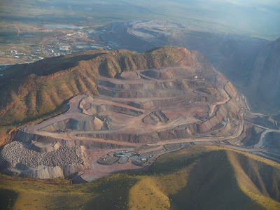
On the return flight we passed over the Argyle diamond mine, the world's largest supplier of diamonds producing approximately 30 million carats per year- one quarter of the world's annual production. Mining has been continuous since 1983.

From trek phase 3

Saturday, September 13, 2008

bungle bungles

In the 1980's my main point of reference about all things Australian was Neighbours, and I clearly remember Helen ( Scot's grandmother ) grabbing an opportunity to go to the Bungle Bungles to paint watercolours of the area. I had no idea what they were, or where they were, but the name stuck in the recesses of my mind.

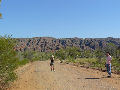
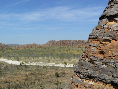
Situated in Purnululu National Park, the Bungle Bungle Range is a series of spectacular beehive-like sandstone domes. Europeans first arrived in the region in the late nineteenth century, but apart from a bit of gold prospecting and some cattle farming the ranges were pretty much unexplored and undocumented. A documentary about the region in 1983 put the area into the spotlight, and a National park was established in 1987 ( I am pretty sure that was when it featured on Neighbours) and in 2003 it was declared a World Heritage area.

The area is a maze of striped domes, many 250 metres high, and the colours of the rock and the surrounding fan palms are quite stunning.

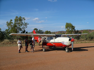
It was with some trepidation that we arrived at the airport at 6 am, but the lovely Alligator Airways pilot seemed to know how to fly a plane and the 1 hour trip to the bungles was smooth and enjoyable.

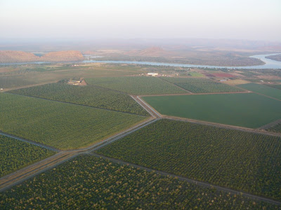
We flew over Lake Argyle, the largest man made lake in Australia, created by damming the River Ord in 1971. It is 54 times larger than Sydney harbour, and boats sailing on it have to have a seafaring licence. It provides irrigation to the Ord basin and hydroelectric power to all the surrounding towns.

From trek phase 3


From trek phase 3


We managed to choose the hottest day of the dry season to date with the temperature exceeding 40 degrees so walking several kilometres around the rocks, through chasms and into gorges was a challenge.Fortunately we started very early but by mid afternoon we were all flagging. The tourist season is winding down at the top end as it is now too hot to do anything.
From trek phase 3


From trek phase 3


From trek phase 3


From trek phase 3
From trek phase 3

From trek phase 3


From trek phase 3

flights of fancy

The Kimberley Ranges and the Bungle Bungles are only accessible by serious 4WD vehicles or plane, so we booked a couple of flights to get a better look. We are getting pretty fearless about these trips and all was well until we met our first pilot, a diminutive kiwi girl who made Ness look large.

She was obviously fairly inexperienced, and too short to see over the cockpit dashboard- I think a booster cushion would have been a useful addition. Her constant use of maps and comments about not having done this trip before made my stomach start to churn even before we started to hit the thermals and were buffeted around alarmingly.

The route took us over the River Ord and north to the coast before crossing the Mitchell plateau and Mitchell Falls, with a lunch stop at a remote cattle station. The coastline was impressive but our pictures were somewhat blurred due to a combination of turbulence, wobbly plane handling and severe handshake!

From trek phase 3


Mitchell Falls were inspiring even in the dry season with minimal water flowing. The roads in are closed in the wet season, and flying is also hazardous, so not many people get to see them in full flow.

From trek phase 3
King George Falls complete with luxury yacht and helipad.

From trek phase 3


It was a relief to get back onto solid ground, and we were both extremely disappointed by the whole day.